

Remote Sensing and GIS in Modern Agriculture: How Data Is Transforming Crop Monitoring
Remote Sensing and GIS in Modern Agriculture: How Data Is Transforming Crop Monitoring
Agriculture is entering a new era of digital transformation. Farmers, researchers, and policymakers are increasingly relying on data-driven technologies to improve productivity, manage resources efficiently, and build resilience against climate change. Among the most influential technologies driving this transformation are Remote Sensing (RS) and Geographic Information Systems (GIS).
The integration of remote sensing and GIS has fundamentally changed how agricultural landscapes are monitored and managed. Instead of relying solely on field observations and periodic surveys, modern agriculture now utilizes satellite imagery, drone technologies, spatial analytics, and real-time environmental data to make informed decisions.
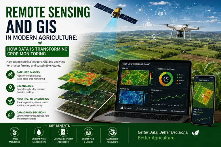
For researchers and agricultural professionals, these technologies offer unprecedented opportunities to understand crop dynamics, predict yields, detect stresses early, and optimize farm management practices.
The Journal of Agrosystems and Analytics (JAA) recognizes the growing importance of geospatial technologies in agriculture and encourages research that advances the application of remote sensing and GIS for sustainable and data-driven agricultural systems.
Understanding Remote Sensing in Agriculture
Remote sensing refers to the process of collecting information about an object or area without making direct physical contact. In agriculture, this information is typically obtained through:
- Satellites
- Drones and unmanned aerial vehicles
- Aircraft-based sensors
- Ground-based sensing systems
- Multispectral and hyperspectral cameras
- Thermal imaging technologies
These platforms capture data regarding:
- Crop health
- Vegetation conditions
- Soil moisture
- Temperature
- Nutrient status
- Water availability
- Land-use changes
The ability to monitor agricultural systems continuously and over large areas has made remote sensing one of the most valuable tools in modern farming.
Understanding Geographic Information Systems (GIS)
GIS is a technology used to collect, store, analyze, and visualize spatial data.
In agriculture, GIS enables researchers and decision-makers to:
- Map agricultural fields
- Analyze spatial variability
- Monitor environmental changes
- Develop management zones
- Integrate multiple datasets
- Support precision farming decisions
GIS transforms raw spatial data into meaningful information that can guide agricultural planning and resource management.
Why Crop Monitoring Has Become a Global Priority
Agriculture faces several significant challenges:
- Climate variability
- Increasing food demand
- Water scarcity
- Soil degradation
- Pest and disease outbreaks
- Rising production costs
- Environmental sustainability concerns
Traditional crop monitoring methods are often:
- Labour-intensive
- Time-consuming
- Expensive
- Limited in spatial coverage
Remote sensing and GIS overcome many of these limitations by enabling rapid, large-scale, and continuous monitoring of agricultural systems.
The Evolution of Crop Monitoring Technologies
Crop monitoring has evolved dramatically during the last few decades.
Traditional Monitoring Approaches
Historically, crop assessment depended on:
- Field surveys
- Manual observations
- Farmer experience
- Sample-based measurements
Although valuable, these methods have limitations in terms of scalability and timeliness.
Modern Digital Monitoring Systems
Today's agricultural monitoring systems integrate:
- Satellite imagery
- Drone technologies
- GPS systems
- IoT sensors
- Artificial intelligence
- Cloud computing
- Big data analytics
The combination of these technologies has created a new generation of precision agriculture tools.
Applications of Remote Sensing in Crop Monitoring
Crop Health Assessment
Satellite imagery can identify variations in crop vigor and health.
Researchers use vegetation indices such as:
- NDVI
- SAVI
- EVI
- GNDVI
These indicators help monitor:
- Plant growth
- Nutrient status
- Stress conditions
- Productivity patterns
Early Detection of Crop Diseases
Remote sensing technologies can identify subtle changes in plant physiology before visible symptoms appear.
Research applications include:
- Fungal disease detection
- Pest infestation monitoring
- Crop stress identification
- Disease outbreak forecasting
Early detection significantly reduces production losses.
Soil Moisture Monitoring
Water availability is one of the most important factors influencing crop productivity.
Remote sensing supports:
- Soil moisture estimation
- Drought monitoring
- Irrigation planning
- Water-use efficiency assessments
This information is particularly valuable in climate-sensitive agricultural regions.
Precision Irrigation Management
Data from satellite and drone imagery can improve irrigation decision-making.
Research opportunities include:
- Site-specific irrigation scheduling
- Water stress detection
- Precision water management systems
- Climate-resilient irrigation strategies
Crop Yield Forecasting
Machine learning algorithms integrated with remote sensing data are increasingly used to predict crop yields.
Applications include:
- National food production forecasting
- Farm-level yield estimation
- Production risk assessment
- Supply chain planning
Accurate yield forecasting supports both farmers and policymakers.
Nutrient Management
Remote sensing technologies can identify nutrient deficiencies and support:
- Precision fertilizer recommendations
- Nutrient-use efficiency assessments
- Variable-rate fertilizer applications
These practices contribute to sustainable agriculture and environmental protection.
Applications of GIS in Modern Agriculture
Land Suitability Assessment
GIS helps determine which crops are best suited to specific areas based on:
- Soil characteristics
- Climate conditions
- Water availability
- Topography
Agricultural Resource Mapping
GIS is widely used for:
- Soil mapping
- Water resource mapping
- Crop zoning
- Watershed management
- Environmental planning
Precision Agriculture Management Zones
GIS enables the identification of spatial variability within agricultural fields.
This information supports:
- Variable-rate fertilizer applications
- Site-specific irrigation
- Precision pest management
- Resource optimization
Climate Risk Mapping
Climate change has increased the importance of geospatial risk assessment.
GIS applications include:
- Flood risk mapping
- Drought vulnerability assessment
- Heat stress analysis
- Climate adaptation planning
Farm Decision Support Systems
GIS-based decision support systems help farmers make informed decisions regarding:
- Crop selection
- Planting schedules
- Resource allocation
- Harvest planning
The Role of Drones in Agricultural Monitoring
Unmanned aerial vehicles have become increasingly important in precision agriculture.
Drone technologies provide:
- High-resolution imagery
- Real-time crop assessments
- Field-level diagnostics
- Precision spraying capabilities
- Rapid data collection
Research opportunities include:
- Autonomous drone systems
- AI-based image analysis
- Disease prediction models
- Precision pesticide management
Artificial Intelligence and Geospatial Analytics
Artificial intelligence is transforming agricultural data analysis.
AI applications include:
- Automated crop classification
- Disease detection algorithms
- Yield prediction models
- Weed identification systems
- Environmental forecasting
Combining AI with remote sensing and GIS enables more accurate and efficient agricultural management.
Remote Sensing and GIS for Sustainable Agriculture
Sustainability has become a major priority in global agriculture.
Geospatial technologies contribute by supporting:
Water Conservation
Improved irrigation efficiency and water management.
Soil Conservation
Monitoring erosion and land degradation.
Biodiversity Protection
Landscape-level ecosystem assessments.
Climate-Smart Agriculture
Developing adaptation and mitigation strategies.
Carbon Farming
Monitoring carbon sequestration and sustainable land-use practices.
Emerging Research Opportunities in 2026
Several research themes are attracting increasing attention.
Hyperspectral Imaging for Agriculture
Advanced imaging technologies can improve crop diagnostics and stress detection.
Digital Twins for Agricultural Systems
Virtual farm simulations support predictive decision-making.
Satellite-Based Carbon Monitoring
Monitoring greenhouse gas emissions and carbon sequestration.
Integrated Geospatial Analytics Platforms
Combining multiple data sources for real-time decision support.
AI-Powered Precision Agriculture Systems
Developing intelligent systems for sustainable farm management.
Climate Resilience Modeling
Understanding agricultural responses to changing environmental conditions.
Challenges in Geospatial Agriculture Research
Despite rapid progress, several challenges remain.
Data Availability
Access to high-quality datasets can still be limited.
Technical Expertise
Advanced analytical skills are often required.
Infrastructure Limitations
Digital infrastructure remains uneven across regions.
Cost of Advanced Technologies
Some technologies remain expensive for small-scale adoption.
Data Integration Challenges
Combining information from different sources remains technically complex.
Addressing these challenges provides additional opportunities for impactful research.
Publication Opportunities for Researchers
The growing use of remote sensing and GIS technologies in agriculture has generated significant demand for high-quality scholarly research.
The Journal of Agrosystems and Analytics (JAA) welcomes original manuscripts in areas including:
- Remote sensing applications in agriculture
- GIS and spatial analytics
- Precision farming technologies
- Agricultural data science
- Crop monitoring systems
- Climate-smart agriculture
- Environmental modeling
- Drone technologies
- Artificial intelligence in agriculture
- Sustainable agrosystems research
Researchers, practitioners, and doctoral scholars are encouraged to contribute innovative studies that advance digital agriculture and geospatial analytics.
Frequently Asked Questions
What is remote sensing in agriculture?
Remote sensing is the collection of agricultural information through satellites, drones, and sensors without direct physical contact with crops or land.
What is GIS in agriculture?
GIS is a technology used to collect, analyze, and visualize spatial agricultural data to support decision-making.
How does remote sensing improve crop monitoring?
It enables continuous monitoring of crop health, water stress, nutrient deficiencies, and disease outbreaks across large areas.
Why is GIS important in precision agriculture?
GIS helps analyze spatial variability and supports site-specific farm management practices.
What are the major research opportunities in geospatial agriculture?
Crop monitoring, yield forecasting, climate risk assessment, AI-powered analytics, and sustainable resource management are major research priorities.
Where can researchers publish remote sensing and GIS studies in agriculture?
Researchers can publish their work in specialized journals focusing on agricultural analytics, precision farming, and sustainable agrosystems, including the Journal of Agrosystems and Analytics.
Conclusion
Remote sensing and GIS are fundamentally transforming modern agriculture. The ability to monitor crops, analyze environmental conditions, and make data-driven decisions has created new possibilities for improving productivity, sustainability, and resilience.
As agriculture faces increasing challenges related to climate change, food security, and resource scarcity, geospatial technologies will continue to play a central role in developing intelligent and sustainable farming systems.
For researchers, the integration of remote sensing, GIS, artificial intelligence, and precision agriculture presents exciting opportunities for innovation and interdisciplinary collaboration.
The Journal of Agrosystems and Analytics (JAA) remains committed to promoting high-quality research that advances agricultural analytics, precision farming, and sustainable agrosystems. Scholars working in these emerging fields are encouraged to contribute their findings and help shape the future of digital agriculture.